MAP STUFF
 |
| Data overload |
Like any thru hiker knows there's a ton of planning involved. Especially with the CDT. Making sense of all the route choices. What's official and what's the ALT. Some of those will dictate your town choices and some will be less of a thing, just making a decision within the particular section.
Since there's two of us we are both going to carry a different map set. I will carry the Bear Creek Map books along with a GPS, compass and Majik will carry the Ley maps, Beacon Data spread and Yogis town guide. Having collected all of the above it is just to hard to make a decision what to leave sitting at home. I know it might seem like over kill and extra weight to add. But in this way it really feels like we got the trail covered. If we get split up we each have maps. Hopefully not though because this is a trail we should be sticking together more so. Now we just need to see it on the ground!
I am interested in it as a experiment of trial and error, to see which set of maps we favor.
As we go, if all the maps seem redundant, than I would opt out for dumping the Bear Creek maps.
I would favor the Leys because they do show all of the variables lending to options and choice. If one were to just stick with the official maps you might be shit out of luck on a few occasions. Where logically and directionally it just doesn't make so much sense. And you will find yourself walking that 3100 miles. Better plan on starting early for that!
I would also say that now having Leys maps printed professionally by Yogis printing press makes a world of a difference in the quality and rivals the Bear creek maps. Leys are simply more diverse.
This is a huge leap forward printing Leys professionally! Would totally recommend paying the $25 to yogi and donating to Ley and calling it done. Instead of buying all the ink $$ and nursing the printer.
Out of all the info we still won't be using any guide book like Wolf's. Mostly because we are going Northbound. And they are written south bound. I do have the Vol 1 Northern Montana that is north oriented. So I might throw that in for the novelty aspect. Undecided.
I have all the old CDTA books as well. They actually have been useful in studying the general spread of the CDT. Watching what has changed and I think has remained the same. There's a few sections of those I thought about throwing in also. Probably not necessary.
Oh yeah, then there's the Delormes and a few Topos.
ROUTES WE ARE TAKING W/ALTS
NM
gila middle frk
Mangas mtns to pietown (old common way)
official- Chain of Craters (might as well be an alt)
Mt Taylor summit
might walk official past Chama River mesa above echo amp -hitch to GHST RNCH
hike out GHST
CO
Going for San Juans
Greys Torrey
might go for Rocky mtn Nat'l
WY
Cirque of Towers
ID
Henry Lakes
MT
Anaconda
Waterton
 |
| honeyville meats and veggies |
FOOD STUFF
Our planning has been even more challenging because we are sending a lot of boxes from home.
Mostly because of Majiks dietary needs. Food allergies and such. If she's sending one, I figured I might as well. Actually in the long run I think this is better. Just way more of a task.
This way we can be real selective of what we are eating. Pack the good stuff. Healthy, nutritionally satisfying meals and snacks. We eat really healthy off trail so this would not be the point to change.
Also in the long run I think we are eating for cheaper than buying in town. And our food weight should be lighter as well.
-HOW ARE YOU DOING THIS?
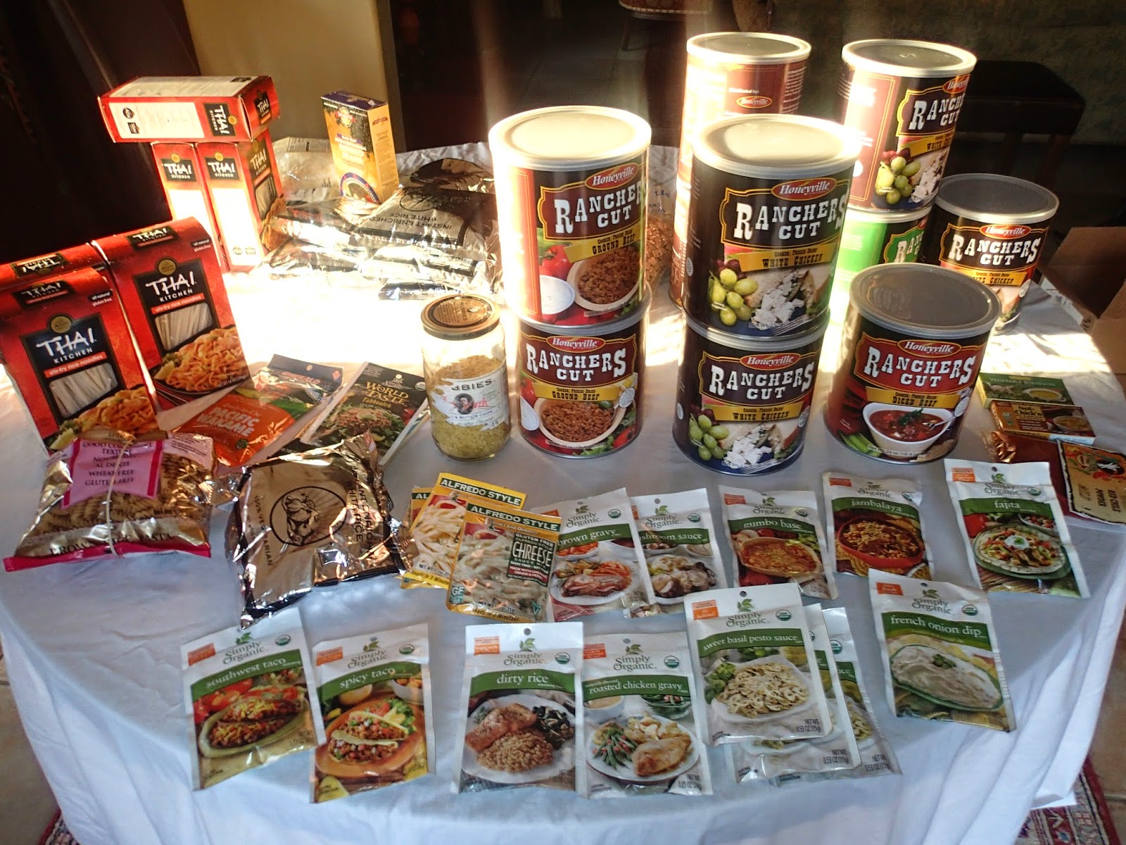
We put together some 85 meals of freeze dried meats and vegetables. Added seasoning packs like Simply Organics- sauces along with a choice of a base carbohydrate- mostly freeze dried rice, mashers or noodle.
Next step is the vacuum sealer for long term preservation.
We bought bulk cans of the meat and vegetables from Honeyville Farms.
-COOKING
should be a breeze- presoak-add boiling water or just soak much longer and eat it room temp UMH........
Talking with Dirtmonger on his Vagabond Loop, turned us on to this concept. He goes completely cook less and just soaks his meals in a little tupper ware container.
I'm not totally ready to go cook less but should prove to be viable if the fuel runs low on few long stretches. Which we are planning on doing, skipping a few of those obnoxious resupply points. Would rather just stay out and make the longer haul.
Using alcohol stoves this time around.
 |
| freeze dried rice by the 5gl bucket! |
 |
love the organic food bars, pricy though$$
protein powder- electrolytes |
-WILL YOU GET TIRED OF THE SAME OL SAME OL ?
Well hopefully not. Hopefully I was creative enough. And there's enough variety within one given box.
And yes we left some towns open for buying in town. Providing even more variety.
We will be using 9 towns for Full Resupply and 18 Mail Drops = 27 stops.
:
-84 MEALS: HOW MANY RESUPPLIES IS THAT?
From my calculations.......hmh.........18 towns and most will be X 2 people =36
Shoes 4 each x 2 =8
Boxes roughly 44
Even viable resupply towns like Pagosa Springs we are sending in. Our strategy is to have the good stuff packed right for such a challenging section.
OTHER STRATEGY would be to supplement snacks in towns if we feel the boxes are inadequately packed. Mostly concerned with providing good meals.
-WON'T THAT JUST COST MORE W/SHIPPING- ARE YOU REALLY SAVING?
The best I can say is use Regional Flat Rate boxes. It's less than half the price compared to Priority mail.
Also we live in NM so the closer your region the better.
Example: Lordsburg 7.00 flat/priority 17.00
Also having already invested in a lot of the food expenses should feel like savings on the trail (psychologically speaking)


